A
MASSIVE EARTHQUAKE ROCKS PAKISTAN MEASURING 8.1 ON THE RICHTER SCALE
HITS
REGION WITH EPICENTRE IN AFGHANISTAN — 60KM FROM CHITRAL - 26th OCTOBER 2015
The earthquake reportedly caused
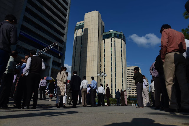
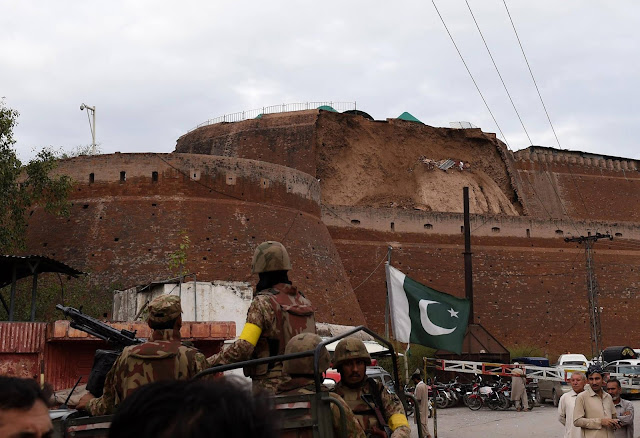
widespread panic across the region with people saying that it caused major
alarm. Many of them took to social media and uploaded the moment when the quake
hit. Residents in several Pakistani cities in the country’s north said that
they could feel the buildings that they were in sway.
The
earthquake struck almost exactly six months after Nepal suffered its worst
quake on record, on April 25. Including the toll from a major aftershock in
May, 9,000 people lost their lives and 900,000 homes were damaged or destroyed.
 |
| MASSIVE 8.1 EARTHQUAKE ROCKS PAKISTAN |
 |
| MASSIVE 8.1 EARTHQUAKE ROCKS PAKISTAN |
 |
| MASSIVE 8.1 EARTHQUAKE ROCKS PAKISTAN |
 |
| 8.1 EARTHQUAKE ROCKS PAKISTAN |
 |
| 8.1 EARTHQUAKE ROCKS PAKISTAN |
 |
| EARTHQUAKE ROCKS PAKISTAN |
Epicenter
According to the US Geological Survey, an
earthquake with magnitude 7.5 occurred at 2.09pm (PST) on Oct 26,
2015. It said the quake was 212.5 km deep and centred 82 km southeast of Feyzabad
in a remote area of Afghanistan in the HinduKush mountain range.
The
Pakistan Metrological Department said the magnitude of the quake was 8.1.
“On
the north-western side of the Tibetan Plateau, beneath the Pamir-Hindu Kush
Mountains of northern Afghanistan, earthquakes occur at depths as great as 200
km as a result of remnant lithospheric subduction. The curved arc of deep
earthquakes found in the Hindu Kush Pamir region indicates the presence of a
lithospheric body at depth, thought to be remnants of a subducting slab.
Cross-sections through the Hindu Kush region suggest a near vertical
northerly-dipping subducting slab, whereas cross-sections through the nearby Pamir
region to the east indicate a much shallower dipping, southerly subducting
slab. Some models suggest the presence of two subduction zones; with the Indian
plate being subducted beneath the Hindu Kush region and the Eurasian plate
being subducted beneath the Pamir region. However, other models suggest that
just one of the two plates is being subducted and that the slab has become
contorted and overturned in places.
Shallow
crustal earthquakes also occur in this region near the Main Pamir Thrust and
other active Quaternary faults. The Main Pamir Thrust, north of the Pamir
Mountains, is an active shortening structure. The northern portion of the Main
Pamir Thrust produces many shallow earthquakes, whereas its western and eastern
borders display a combination of thrust and strike-slip mechanisms. On the 18
February 1911, the M7.4 Sarez earthquake ruptured in the Central Pamir
Mountains, killing numerous people and triggering a landside, which blocked the
Murghab River.”
What caused the quake?
US Geological Survey says in its report
that earthquake near the Hindu Kush region of Afghanistan occurred as the
result of reverse faulting at intermediate depths, approximately 210 km below
the Hindu Kush Range in northeastern Afghanistan.
Reverse
faulting is a geologic fault in which the hanging wall moves upward
elative to the footwall. Reverse faults occur where two blocks of rock areforced together by compression.
Focal
mechanisms indicate rupture occurred on either a near-vertical reverse fault or
a shallowly dipping trust fault. At the latitude of the earthquake, the India
subcontinent moves northward and collides with Eurasia at a velocity of about
37 mm/yr.
Active
faults and their resultant earthquakes in northern Pakistan and adjacent parts
of India and Afghanistan are the direct result of the convergence between the
India and Eurasia plates. This collision is causes uplift that produces the
highest mountain peaks in the world including the Himalayan, the Karakoram, the
Pamir and the Hindu Kush ranges.
“Earthquakes
such as this event, with focal depths between 70 and 300 km, are commonly
termed “intermediate-depth” earthquakes. Intermediate-depth earthquakes
represent deformation within subducted lithosphere rather than at the shallow
plate interfaces between subducting and overriding tectonic plates. They
typically cause less damage on the ground surface above their foci than is the
case with similar magnitude shallow-focus earthquakes, but large
intermediate-depth earthquakes may be felt at great distance from their
epicenters. “Deep-focus” earthquakes, those with focal depths greater than 300
km, also occur beneath northeastern part of Afghanistan. Earthquakes have been
reliably located to depths of just over 300 km in this region.”


No comments:
Post a Comment